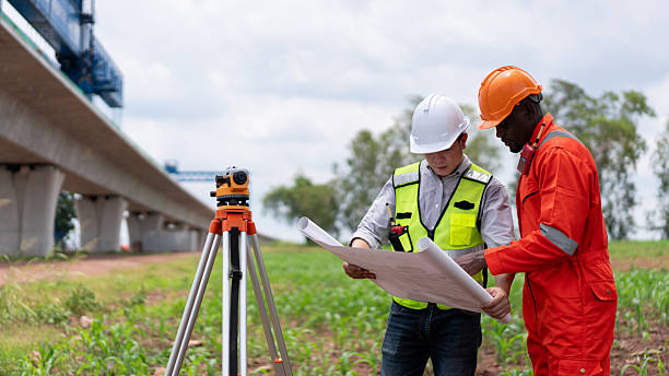
Modern surveying depends on more than tripods, stakes, and handwritten notes. Field crews now use satellite positioning, drones, laser scanning, digital mapping, and modeling software to collect more information in less time while keeping measurements tied to reliable control. Together, these tools help a land surveyor document boundaries, terrain, structures, and site conditions.
GPS Receivers for Precise Field Positioning
Survey-grade GPS receivers use signals from multiple satellite systems to determine precise positions across a site. Unlike consumer navigation devices, professional GNSS equipment works with correction data, known control, and established coordinate systems to reach survey-level accuracy. Property owners searching for a land surveyor near me may see crews use a base receiver, rover, or network connection to establish corners, collect topographic points, and connect distant portions of a property without setting up an instrument at every location. Trees, buildings, and steep terrain can weaken satellite visibility, so surveyors still combine GPS with other equipment when conditions call for it.
UAV Drones for Mapping Large or Hard-to-Reach Sites
Drones can collect hundreds or thousands of overlapping images during a planned flight over a large property. Aerial coverage works well for open tracts, construction sites, quarries, drainage corridors, and areas that would take much longer to walk point by point. Large sites can be mapped quickly, but the aircraft does not replace ground control or professional review.
Pilots follow flight plans that control altitude, image overlap, and coverage so the data can be processed accurately. Ground control points or checkpoints help tie the aerial images to known survey positions and provide a way to test the finished results. Anyone comparing survey companies near me should understand that drone mapping is most useful when it is supported by field measurements.
LiDAR Scanning for Detailed Terrain Measurements
LiDAR sends rapid laser pulses toward the ground and measures the time they take to return. Laser scanners can capture dense clouds of points across slopes, structures, roadways, vegetation, and other surfaces that are difficult to represent with a small number of conventional shots. Dense point data helps surveyors model subtle grade changes, embankments, drainage paths, and complex site features. That information can support topographic mapping, volume calculations, corridor work, and existing-condition surveys. Owners searching for a property surveyor near me may encounter LiDAR on projects where detailed surface information matters more than a simple boundary drawing.
Photogrammetry for Building Accurate Site Models
Photogrammetry creates measurable site information from overlapping photographs taken from the air or ground. Overlapping images allow software to identify matching points and calculate their three-dimensional positions. Software then builds surfaces, point clouds, and textured models that can be checked against survey control.
Accuracy depends on image quality, camera position, site conditions, and the strength of the control network. Projects with tall vegetation, reflective surfaces, or hidden ground may still need direct field measurements to fill gaps that photographs cannot see. People looking for surveyors near me should expect photogrammetry to be used as part of a larger modern survey workflow rather than as a replacement for professional boundary evidence.
High-Resolution Orthomosaics for Property Mapping
Orthomosaics combine many aerial photographs into one corrected image that has a consistent scale across the site. Individual photos contain perspective distortion, but processing adjusts those differences so mapped features can be viewed in their proper horizontal relationship. Mapped driveways, buildings, pavement, tree lines, drainage features, and construction activity become easier to understand when shown over a current aerial base during planning. Clients requesting a property line survey may also find an orthomosaic useful for visual context, although the photograph itself does not establish the legal boundary.
3D Modeling for Topographic and Cadastral Surveys
Three-dimensional models turn collected survey points into a surface that shows how land rises, falls, and changes across a property. Terrain models can display contours, breaklines, ridges, ditches, retaining walls, and other features needed for grading or drainage work. Designers use these models to study proposed roads, building pads, earthwork, and stormwater improvements against existing conditions.
Cadastral work uses digital geometry for a different purpose by showing how legal parcels fit together. Boundaries still depend on deeds, monuments, recorded plats, and professional analysis rather than software alone. Searches for surveyors near me may lead to firms that combine 3D terrain data with boundary information, giving engineers and planners a coordinated base for development without confusing physical site features with legal ownership lines.
Digital Field Data Collection for Survey Drawings
Digital field collection replaces much of the manual transcription that once happened between a survey instrument and the drafting desk. Tablets and data collectors can store point numbers, descriptions, feature codes, coordinates, and field notes as crews work, reducing the chance that handwritten information gets misread later. Recorded data can flow into CAD or mapping software, where technicians build linework, surfaces, labels, and final survey drawings from the same information gathered on site. The Land Consultants provides land surveying and civil engineering services in the Huntsville area, using modern field and mapping technology to support boundary work, topographic surveys, development planning, and construction projects with dependable site information.